
West Virginia County Map with County Seat Cities
|
State Rankings
| Overall Rank Out of 50 | #47 |
| Health Care | #44 |
| Education | #45 |
| Economy | #49 |
| Opportunity | #23 |
| Infrastructure | #50 |
| Crime & Corrections | #31 |
| Fiscal Stability | #36 |
| Quality of Life | #45 |
| Last Updated: | June 22, 2018 |
West Virginia Drought Map
|
West Virginia Elevation Map
 |
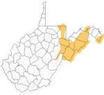
West Virginia Waterfall: Blackwater Falls
 Blackwater Falls State West Virginia County Tucker Nearest city Davis, West Virginia Blackwater Falls is located in Blackwater Falls State Park in the Allegheny Mountains of West Virginia, where Blackwater River enters Blackwater Canyon. This well-known cascade waterfall is approximately 62 feet high. The river was named due to its coloration, caused by the tannins of local plants. |
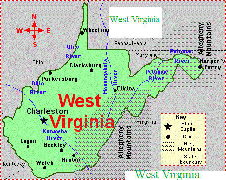
West Virginia Lakes, Rivers and Water Resources
 West Virginia Rivers Shown on the Map: Big Coal River, Big Sandy River, Cacapon River, Elk River, Gauley River, Green Brier River, Guyandotte River, Little Kanawha River, Middle Island Creek, Monongahela River, New River, North Branch Potomac River, North Fork, Ohio River, Potomac River, South Branch Potomac River, South Fork, Tug Fork, Tygart Valley River and West Fork River. West Virginia Lakes Shown on the Map: Bluestone Lake, Summersville Lake, Sutton Lake and Tygart Lake. |
Maps

|
West Virginia Department of Agriculture

|
Potomac River
|
Where does the Potomac River start and end? The Potomac River runs 405 miles (652 km) from Fairfax Stone Historical Monument State Park in West Virginia on the Allegheny Plateau to Point Lookout, Maryland, and drains 14,679 square miles (38,020 km2). The length of the river from the junction of its North and South Branches to Point Lookout is 302 miles (486 km).[4] The average daily flow during the water years 1930-2017 was 11,416 cubic feet (323.3 m3) /s.[1] The highest average daily flow ever recorded on the Potomac at Washington, D.C., was in March 1936 when it reached 426,000 cubic feet (12,100 m3) /s.[1] The lowest average daily flow ever recorded at the same location was 601.0 cubic feet (17.02 m3) /s in September 1966 What is the source of the Potomac River? Appalachian Mountains The river has two sources. The source of the North Branch is at the Fairfax Stone located at the junction of Grant, Tucker, and Preston counties in West Virginia. The source of the South Branch is located near Hightown in northern Highland County, Virginia. The river's two branches converge just east of Green Spring in Hampshire County, West Virginia, to form the Potomac. It flows more than 600 kilometers, from the Allegheny Mountains to the Chesapeake Bay and finally into the Atlantic Ocean. What city is located on the Potomac River? Harpers Ferry Which state owns the Potomac River? West Virginia The Potomac River begins at a spring in the northeastern corner of Tucker County. Tucker County Map of West Virginia highlighting Tucker County 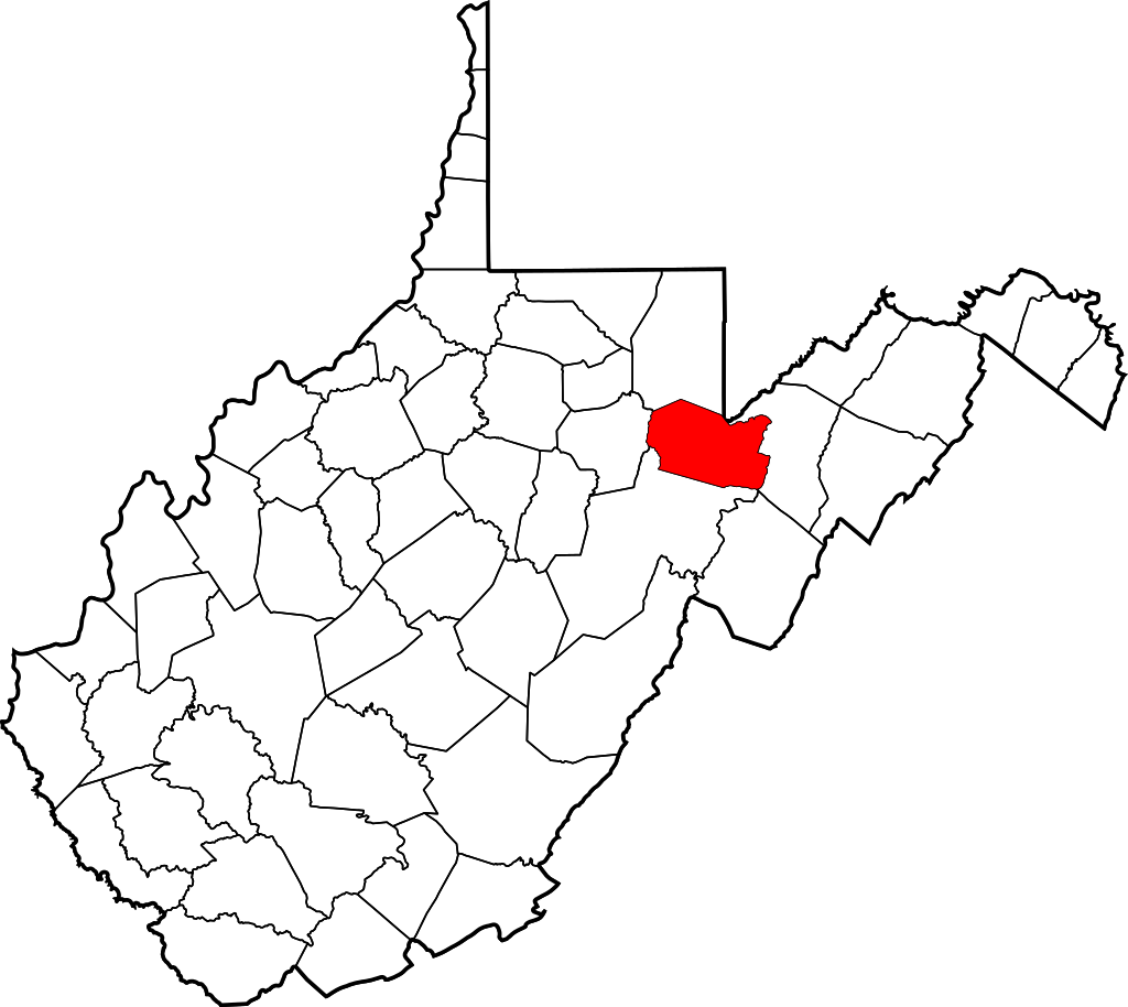 Tucker County lies in north-central West Virginia and includes some of the state’s most rugged and mountainous terrain. Tucker County, West Virginia County seat: Parsons Population: 6,966 (2015) Points of interest: Blackwater Falls State Park From west to east, the Potomac in West Virginia courses along the borders of northern Hampshire County, northern Morgan County, northern Berkeley County, and eastern Jefferson County. Its principal tributaries in West Virginia, in addition to the Shenandoah and its north and south branches. Jefferson County The lowest point in the state of West Virginia is located on the Potomac River (just east of Harpers Ferry) in Jefferson County, where it flows out of West Virginia and into Maryland. |